Sunday, December 25, 2022

Book Review: The Lunch Tree

 The Lunch Tree by Irene Cornwall Cofer, Mohave Pioneers Historical Society Inc., Kingman AZ, Drawings by Roy Purcell, 1969.  Available at Kingman Library.  Mostly this is a primary source work as Cofer describes her life and experiences.

Irene Cornwall was born, and mostly raised in the Sandy River area, close to present day Wickieup.  She presents stories form her own life, as well as articles dealing with the lives of those around her.  As a young girl her mother passed away and they moved to Kingman for a couple of years where her father was Mohave County Treasurer. 

She provides a story of meeting a woman from the Red Light district in Kingman--which was located at first and Beale at the time and later had to be relocated as it was too close to the school.  It was known as the Rabbit Patch and Black Jack ruled as queen.  On one occasion the author thinks she met Black Jack.  The lad she met called her "Baby."  She was eight at the time.

She also describes going past the slaughter house after crossing under the railroad bridge.  There were cattle ranging close by to the slaughter house.  This and other things I have read makes me think slaughter house canyon us named for the meat packing plant, and not for a moaning woman ghost who murdered her children.  

She described the wagon trip from Kingman to the Sandy River area.  The route followed the west side of the Hualapai Mountains and cut over to the Sandy Valley through Signal which was a larger town then and had a mining mill.  There were several stops along this route and they would stay with different people along the way enjoying their hospitality.  The "Lunch Tree" was one such stop.

This book is a good genealogy source if you have relatives who lived in the area, especially the Wickieup area.  She also gives information on people who lived in Signal, Hackberry and Kingman.  She provides a good description of their home life after they returned to The Big Sandy farm and ranch after living in Kingman a couple years.  She and her older sister took over the household chores which often included serving others who came to collect mail as the ran the post office and if people came at dinner time they would expect to be fed.  Traveling was harder in those days, and farms were far apart.  

Tuesday, December 13, 2022

Book Review: Kingman-Arizona

 Kingman-Arizona: City in Mohave County by Roman Malach, printed by Graphicopy, New York, 1974, Arizona Bicentennial Commission. 

This is a brief version of the history of Kingman Arizona up through 1974.  Kingman started in 1882 as a railroad town.  It was originally called Sheffield's Railroad Camp for the individual who first platted the city and sold lots.  However the name Kingman took hole after the individual who decided a train stop was needed here.  In 1887 the county seat was moved from Mineral Park to Kingman.  A few things I found interesting.  There is the mention of a slaughterhouse in Kingman.  This makes me think that Slaughterhouse Canyon takes it name form the meat packing rather than the weeping ghost.  He quotes the phone book and local businesses which informs me that there was a Church of Jesus Christ of Latter-day Saints in Kingman before 1940.  (This would be the Oak Street Baptist Church at  Oak and Sixth streets.)

Harvey House was an important restaurant for travelers on the train.  It was next to the train station.  The original courthouse in Kingman was a rented building which became the Commercial Hotel.  The first constructed courthouse was close to where the courthouse is now.  It wasn't until 1915 that the current courthouse was built.  Fourth of July rodeos were held, and at times cars were used to form the arena.  Kingman also had a ball team which would play with other nearby communities. 


Port Kingman was established by Charles Lindbergh and the airport was dedicated i 1928.  The original airport was by Bank and Airway.  It was part of a series of airports from Las Angeles to New York called the Transnational Airline later to become Trans World Airline.  

Kingman was incorporated in 1952.

Wednesday, December 7, 2022

Book Review: Mohave County, Arizona, USA, One Thousand Miles of Shoreline

Mohave County, Arizona, USA, One Thousand Miles of Shoreline by Carlos Elmer, W A Krueger Company, Phoeniz, AZ, 1974.  This book is in the Arizona section of the Kingman library.

This is a photographic essay of Mohave County, focusing mostly on the lakes but also including the Hualapai Mountains, the Arizona Strip, Grand Canyon National Monument (west of the Grand Canyon, Big Sand River and Aquarius Mountains, and Joshua Trees.

The highlight of tourism in Mohave County are the lakes on the Colorado River, Lake Mead formed by Hoover Dam, Lake Mohave formed by Davis Dam, and Lake Havasu formed by Parker dam.  There are also desert lakes by Topock.  With lakes comes boating and fishing.  But lakes are also for swimming and just sitting beside and enjoying the view.  An unusual tourist attraction in Mohave County is London Bridge which connects an island to the rest of Lake Havasu City which is now the largest city in Mohave County.

Hoover Dam and Lake Mead

Lake Mohave

London Bridge in Havasu
These picture are copyrighted in 1974.  No infringement intended.


Saturday, December 3, 2022

Book Review: Kingman Army Air Field

 One of my regrets in moving to Kingman is we arrived too late to tour the museum at the airport that memorialized the Army Air Field.  It closed like a year before we moved here.  I went looking for it and found the hangar it had been in, but it was empty.  

I found a binder with information on the Army airfield at the Kingman Library.  This is marked reference so you cannot check it out. However they allowed me to make a copy.  It is either in the Arizona section or in the reference section.  It seems to move back and forth.  It was compiled by Bob Chilcoat in 2017.

The Kingman Army Airfield was born out of WWII.  There was such a need for an air training location that worker were diverted from the Davis Dam project to finish the airfields.  The air field was set up to teach gunnery for the B-17.  It was the sixth such school, and the largest.  The major portion was what would later become the Kingman Airport.  

The school was first called Flexible Gunnery School at Kingman.  However as of May 1943 the name was changed to Kingman Army Air Field.   The school was activated August 1942 and the first class was in January of 1943.  The classes were progressive, starting with bb gun shooting, then skeet shooting, and finally air to air shooting. It would be inactivated at the end of the war, summer of 1945, and closed Feb. 25, 1946.  36,000 gunners were trained.  

The base included all the things you would see in a small community: library, post office, chapel, movie theater, stage with base orchestra and regular dances, day room, large cafeteria, hospital, etc.  The base hosted many celebrities including Bob Hope and his troupe.  Also the Three Stooges visited.  

There were actual seven sub bases to KAAF.  This includes the main base in Kingman, the ground to ground range also in Kingman, Red Lake Field, Antares or Hackberry, Yucca, Topock, Signal and Lake Havasu.  Lake Havasu was often used as a place for soldiers to recreate in Lake Havasu.

Subsequent to this the base was converted to Storage Depot 41.  Word was received in September of 1945 of the change, and the first plane was received on October 19, 1945.  Planes from all over the world were no longer needed and many were flown to Kingman for storage or disposal.  By the end of the year there were almost 5000 aircraft in Kingman.  The highest total officially would be about 5500, however many have said there were 7000 aircraft, the highest total in the world to that point.  Mostly these were large bombers, but there were other aircraft as well.  Some were pot marked with shrapnel and barely flyable.  However there were no accidents in bringing the aircraft to Kingman.  

I most enjoyed in this collection, the article from the Arizona Highways magazine.  Here they described the final resting place and salvage of the aircraft, some of which was very important to those who flew in them.  A few were rescued, like Enola Gay that dropped the atomic bomb.  It is now in a museum.

This collection also has plenty of pictures.  I share a few but there are many more in the binder.


skeet shooting while moving


Kingman Storage Facility
Kingman and subbases


A training devices using movies


oxygen room, gives the fell of being at 30,000 feet

chapel

Bob Hope and crew


Sunday, November 20, 2022

Timothy McVeigh and Michael Fortier in Kingman

The events of April 19, 1995 in Oklahoma City brought the world to Kingman, Arizona.  The Oklahoma City bomb detonated at 9:02 a.m. and destroyed the Murrah building.  This was a federal building.  It held offices for federal employees including Social Security Administration, Veteran's Administration, United States Secret Service, Drug Enforcement Administration and Bureau of Alcohol, Tobacco and Firearms.  It also housed a day care, America's Kids.  500 people worked in the building.  A third of the building collapsed as a result of the blast.  168 people were killed, including 19 children.  Hundreds more were injured.  The building was demolished and a memorial put in its place.  This is still the worse domestic terrorism action.

Timothy McVeigh had planted the bomb, using a rider truck with a mixture of fertilizer, diesel fuel and other chemicals which was then detonated to deadly effect.  McVeigh had perfected his explosive techniques in the desert around Kingman.  He was drawn to Kingman as his friend from military service, Michael Fortier lived here.  They shared antigovernment sentiment.  Both were upset with the Branch Davidian intervention in Waco, Texas.  

Timothy McVeigh was originally from New York, Mike Fortier from Kingman, and a third man, Terry Nichols, who had a more active part in the plot from Michigan.  It was he and McVeigh who rented the truck and turned it into a bomb.

McVeigh lived in several houses in the Kingman area over a couple years before the bombing, including staying with Fortier and his wife, and renting a residence in Golden Valley.  When staying with Fortier they would discuss antigovernment literature and ideas.  At one time he showed Fortier and his wife how he intended to make the bomb, using soup cans to represent barrels of chemicals and kerosene.  Fortier and his wife attended several test bombs detonations; mostly pipe bombs.  This tests would take place in the desert by Kingman but I am not sure where.  I heard it might be off of Stockton Hill Road.  Fortier lived in a mobile home complex.  Again I have not been able to find an address.  

McVeigh would not always stay with Fortier.  He would often stay at hotels in Kingman, once on west Beale, but also Hill Top and a Motel 6.  He had several jobs in Kingman, including as a security guard and also worked at True Value Hardware where Fortier also worked.  Fortier introduced McVeigh to drug usage, including marijuana and methamphetamine.

Fortier traveled with McVeigh; and went with him to check out the Murrah building at one point.  He also received stolen arms from McVeigh and sold them at gun shows and used part of the money to help McVeigh finance his final operation.  

When McVeigh left Kingman to actually bomb the Murrah building, Fortier declined the offer to go with him.  So in essence he knew of the plot, but did not participate in the actual bombing.  

When confronted by the FBI within two days of the bombing, Fortier lied and said he did not know McVeigh or his bomb plot.  However he eventually turned.  For a plea bargain agreement he became the primary witness against McVeigh and Nichols.  Fortier received a twelve year sentence for his involvement.  He served ten and then went into witness protection plan.  His parents, who lived in Kingman moved away as the result of these events.  Timothy McVeigh was convicted and executed.  Terry Nichols received a life sentence.  Fortier's wife was not charged despite knowing of the plot.  This was part of the plea bargain arrangement of Michael Fortier.  

McVeigh

Fortier

Nichols
I understand the presence of the FBI in Kingman, as well as national media made for a rather uncomfortable period.  Many people were interviewed about their association with Timothy McVeigh.  Also Kingman was put in a negative light by the national media, and the generalization was that Kingman residents were nothing but meth addicts and pot smokers and gun toters.  It took some years for this stains to fade away.  I knew nothing of the connection with Kingman until I visited the library of the Mohave County History Museum and was directed to a box of materials by the matron.  I also found plenty of information online.


Tuesday, November 15, 2022

Book Review: Mohave County Place Names

Mohave County Place Names by Roman Malach, Kingman AZ, 1976.  Available at Mohave County Library, Kingman. Sometimes this book gives the origin of place names, and sometimes it does not.  However it does list 60 different places.  This is just a drop in the bucket when you calculate there were 13,000 mines in the county.  I will try to share a few.

Arizona Strip refers to the area of the county that is north of the Colorado River.  It is not easily accessible from the Kingman area as one has to travel through Las Vegas and then through Utah and back south to reach the majority of the area.  However it represents a third of Mohave County.  Cane Beds is a Mormon Community in the strip.  It is named for wild cane which grew in the area.  Once had a school but mostly abandoned now.  Kaibab Reservation was established in 1917.  Moccasin is a Mormon community established in 1864 as a spring was discovered and farming attempted.  A paved road goes form Pipe Springs to Moccasin where a school is located.  Pipe Spring was originally a Mormon community where the attempted farming and ranching using the spring.  More recently purchased by the government and now a National Monument.  Mount Trumball has a good spring.  There was a sawmill from were wood was harvested for the St. George Temple.  There was also a school but no residents remain.  Tuweep Valley is close by.  Once occupied by ranchers but only their empty houses remain.  Wolfe Hole is another ranching community in the area.

Aubrey City is at the confluence of Colorado and Williams River and is now under water of Lake Havasu.  It was a place for transporting supplies to mines up the Williams River.  It is named for Francoise Aaview Aubrey.  Planet City is about twelve miles from Aubrey and was a rest area town for those traveling to McCracken Mine.  McKracken Mine is in the south of Mohave County east of Lake Havasu.  It is named for the finder of the mine.  The ore was milled in Signal.  Also in the area was a Mexican community called Tortilla FlatRawhide was also in this area where some mines can still be seen on the hills.  

Beale's Spring is named for Lieutenant Edward F. Beale whose company stopped here for water in his 1857 to found a wagon trail across Arizona.  It has been used as a stage coach station, a military post, for one year as a reservation for the Hualapai.  It has had a hotel, restaurant and swimming facilities.  Most of the water is diverted to Kingman City.

Big Sandy River runs from the Hackberry area south to the Williams River.  It was named by Lt. A. Whipple as it runs through a sandy wash.

Black Mountains is a range stretching from northern Mohave County to the Union Pass.  It was named by Lt. Joseph Ives.  El Dorado is a mining area in the Black Mountains area west of Last Crossing.  El Dorado a goes down to Mohave Lake on the Colorado River.  The canyon extends on the other side of the river where mining also occurred in Nevada.  

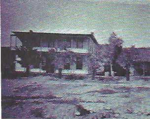
Bonelli Crossing is named for Mormon pioneer Daniel Bonelli.  He ran a ferry across the Colorado River.  Also known as Rio Ville.  He constructed a large home and this was a place for rest for travelers.  

Bullhead City is a newer community and is named for Bullhead Rock which is mostly covered by Lake Mohave.  It was a service station for those working at Davis Dam.  Davis Dam was originally called Bullhead Dam but the name was changed to Davis for Arthur Powell Davis a former Director of Reclamation.  Hardyville is a couple miles down river from Davis Dam.  It was a Colorado River landing established by William Harrison Hardy.  It was the second county seat and Hardy was county supervisor at one point.  Silver Creek Wash flows from Goldroad to the Colorado River here.  Fort Silver was along the wash.  Katharine was the name of a mine discovered by J.S. Bragg and named for his sister.  East of Bullhead is the Silver Creek area with Moss Mine discovered by John Moss.  Secret Pass was known to Native Americans where there are caves to sleep in and a spring for water.  South of Union Pass which is the pass on Route 69 between Golden Valley and Bullhead.  

The Cerbat Mountain Range hosted many mines and communities.  Cerbat was located in Cerbat Canyon.  It was the third county seat 1871-1873.  There are many mines in Cerbat Canyon.  By the early 1900s the mines had played out.  Cherum Peak is the highest peak in the Cerbat range.  It was named for a Hualapai chief.  It is behind the community of Chloride.  Chloride is a community with many mines in the area.  It is about fifteen miles south of Cerbat.  Golcanda, a mine in the Chloride area is credited with producing $6,500,000 in minerals in two years.  It burned down and was never rebuilt as supplies were in short supply during WWI.  Mineral Park is the fourth county seat.  At one time it was the largest community in the county.  It is between Cerbat and Chloride.  It is known for an open pit copper mine which is still mined on occasion.  It also has a large turquoise mining operation.  Stockton Hill is located north of Kingman in the Cerbats and once had many mines.  

Dolan Springs is a newer community.  At one time the area was owned by Daniel Bonelli and there was a corral there.  Dolan may be a man held for drunkenness at Beale Springs.  There is a spring there used by the community.  Dolan Springs is on the Pierce Ferry Road 30 miles north of Kingman.  Lost Basin is between Dolan Springs and Pierce Ferry and was the location of many mines.  Farther than Lost Basin but still between Dolan Springs and Pierce Ferry is Meadview.  This is a new subdivision type community.

Glenwood is a community along the Colorado River across from Needles.  Rail workers settled there and raised gardens, mostly melons.

Gold Basin is in the White Hills area.  There were several mines in the area.  The nearest rail station was Hackberry, about 40 miles distant.

Goldflat is a mining district southwest of Kingman in the McConnico area. The bimetal mine is known as McGuire Mine for the owner.  McConnico was a train station five miles from Kingman.  It is where the Chloride line met the main line.

Hackberry was named for the Hackberry trees in the area.  It started as a mining town snd is along Route 66.  Music Mountains are located close to Hackberry where several mines were located.

Hoover Dam is named for President Hoover.  Lake Mead is named for Elwood Meed the Bureau of Reclamation director at the time.

Hualapai Mountain is named for the Native American Tribe.  It is the highest range in Mohave County.  The highest peak is 8268 feet.  There are many mines in the area.  Lafayette Maynard gave his name to the Maynard Mining District which included the American Flag Mine, on the west side of the Hualapai Mountains near the summit.  Boriana Mine was a tungsten mine and resulted in a rather large community.  45 persons attended school. It is in the Hualapai range.  Abandoned before 1963.  Cedar Mining District is southeast of the Hualapai.  Also here was the Lost Cabin Mine, which was later found and mined.  Copperville was another mine in the area.  Free's Wash, named for John Free was an important watering place in the Hualapai range.  Hualapai County Park is a camping park. 

Hualapai Reservation is along the Colorado River.  Peach Springs is the major city of the reservation.  The West Rim of the Grand Canyon is on the reservation.  Peach Springs is named for a spring that had peach trees nearby.  It was originally a stage coach stop and is now reservation head quarters.

Kingman is named for Lewis Kingman who established the railroad stop.  There were no intentions for a city but Conrad Sheffield applied for the town ship and then subdivided the down down area.  Kingman became the county seat in 1887.  

Lake Havasu City is the newest and now the largest community in Mohave County.  During WWII the peninsula (now island) was used as a substation for the Kingman Army Air Field.  Robert McCulloch purchased the area and established the city.  London Bridge is now there.  This area was previously known as Liverpool Landing, Pittsburg Landing and Godman.

Littlefield is a small Mormon community just north of Mesquite.  It is separated from the Arizona Strip by the Virgin mountains.  Also the community of Beaver Dam is in this area.

Fort Mohave was first established as Fort Colorado in 1859.  It was abandoned during the Civil War but reestablished in 1863 and ran until 1890 when turned into an Indian boarding school.  This was abandoned in 1934 and the buildings subsequently dismantled.  Fort Mohave is south of Bullhead.  Mojave City, adjacent to the fort was a civilian community and the first county seat of Mohave County.  

Oatman area had many mines.  Oatman was established in the early 1910s and had as many as 50 mines in the area, and a high population of 10,000.  It is named for Goldroad produced millions of dollars but is long gone. Boundary Cone was named by Lt. Ives as the 35th parallel goes through the area.  Mazona was an area adjacent to Oatman.  The business section was destroyed by fire and never rebuilt.  Milltown below Oatman had a mine and a large mill connected by rail.  It also had homes for miners.  However it was short lived.  Old Roads is also just below Oatman and had its own business district including a swimming pool.  Sitgreaves Pass along Route 66 was named for Lt. Lorenzo Sitgreaves by Lt. Joseph Ives.

Sharp's Bar was named for a prospector in the area, C.M. Sharp.  It is now known as Willow Beech on the Mohave Lake, Lake Mead National Recreation Area.

Sweeney is opposite Needles.  Bill Sweeney once operated a ferry here.

Temple Bar is on the south shore of Lake Meed.  It is several bars and cliffs, one which looked like a Mormon Temple to Daniel Bonelli.  

Truxton Canyon was once a stage coach stop and is close to Route 66 and Valentine.  Valentine has a section which pertains to the Hualapai Reservation and was once home to an Indian boarding school.  Named for Robert G. Valentine former commissioner of Indian Affairs.

White Hills are a group of hills east of Last Stop on Route 93 where there were several silver mines.  It was devastated by a flood and abandoned.

Willow Grove Camp endured a short time 1864-1869 as a place to watch the Hualapai during hostilities and protect the Mohave-Prescott Road.  

Yucca is a community on the I-40 about ten miles west of Kingman.  Ford proving ground facility is located her.


Monday, November 14, 2022

Documentary Review: The Perfect Exit: Kingman, Arizona

 This video is available through Kingman Library.  It was produced in 2009.  I follows the exploits of Boze Bell and his band mates as the decide to get together 40 years after their high school days and perform again as a band.  The end up with a few more, so it is nine people who are going to play.  The band was called The Exits, as they figured that is where everyone would head when they played.  However come the day of the concert, Boze Bell the drummer had a massive heart attack.  For a time there was fear he would not make it; but they played the concert that night anyway, and agreed to another in which Bell could participate.  

Bob Bell was born in Iowa in 1946.  At six months the family moved to Peach Springs, AZ, and then ten years later to Kingman.  His father ran a station on Route 66 and his family were farmers in Iowa.  On his mothers side they were mostly ranchers in Kingman.  When the family moved to Kingman Boze met Charlie Waters.  The two hit it off and would become The Exits in junior high with friends Wayne Rutschman, Terry Mitchell and Steve Burford.  

They presented two concerts after over forty years in Kingman.  The first, The Exits Family, and then a year later, Music is the Cure.  Both concerts turned into benefits, the second for the local hospital.  Other local musicians joined the group for the concerts: Mike Torres, Roger Enrico, Steve Paroni, Larry Archer, Ken Kingman, John Waters, Gary Conrad, Vern Andrews, Michael Quine, Dan Harshberger, Bebe Dezier, Raelene Havatone and Steve Burford.  Raelene's father, Wendell Havatone was a member of the original group who had passed away.  

The video includes many pictures of Kingman from the 60s.  Also many memories of the basketball team.  In the extra scenes section there is a slide of pictures from the yearbook sponsors at the time.  Most of the businesses are no longer with us.  


Monday, November 7, 2022

Makah Culture as presented at the Makah Cultural and Research Center Museum of the Makah Indian Nation

The Makah museum houses 300-500 year old artifacts recovered from the Ozette Archeological Site which had ben covered by a mud slide some 500 years ago.  This was a village on the coast.  The museum presents much of this culture which included whaling, fishing with nets for salmon, seal hunting. The seal clubs, made for hitting the seal in the head take the shape of seals.  The whale boats were very interesting with eight people in each whale boat.  Only a member of the chief's family would man the harpoon.  When the speared the whale a bladder attached to the rope would slow the whale down.  When the whale was killed one member of the crew had to quickly jump into the water and sew the mouth of the whale shut so it would stay afloat and would be easier to bring to shore.

The museum did not allow pictures but these are from the Olympic National Park Visitor Center in Port Angeles

This shows the rope and bladder that would tire the whale

While whale hunting presented it problems, the seal hunting also had special tools.  There was a long two-pronged spear with which to attack the seal at enough distance it couldn't get to you.  The seal clubs were also very interesting and very artistic.  They would often be carved to look like a seal.
picture borrowed from internet
One of the most fascinating things were the boxes used for storage.  These would be on fishing boats, or in the home.  Rather than use separate pieces, one board would be used, and carved thin in the corners, and then folded to make a box after a bottom was added.  It was amazing the craftsmanship  put into the boxes.
The Makah people used cedar bark for making many things, including matts, hats and clothes.  The bark would be peeled, and then pounded to make it softer, and then woven into many different materials.  This is the only material that survived from 500 years ago but it is believed there must have been other materials used that decayed over time.  

The long houses built by the Makah people were very large.  More than one family would live in a house and each family would have their own section.  The ability of the Makah people as demonstrated by the long houses and the boxes was superb.

There was netting discovered amongst the artifact at the Ozette site thus proving that using nets to catch salmon was a cultural activity of the Makah.  

Artifacts for game playing were also found at the site.  Art was put into many of the artifacts.

Sunday, November 6, 2022

Book Review: Fry Bread: A Native American Family Story

Fry Bread: A Native American Family Story by Kevin Noble Maillard, illustrated by Juana Martinez-Neal, Roaring Brook Press, New York, 2019

This is a picture book, but the theme seems more geared towards adults rather than children.  It presents the cultural significance of fry bread; as food, as shape, as sound, as color, as flavor, as time, as art, as history, as place, as nation, as everything, as us and as you.

After telling the stories in a storybook fashion, the author goes back and explains in a more adult fashion his reasons for the story.  He includes all Native American Nations in the inside cover of the book.  

His recipe for fry bread is different than mine or any I am familiar with.  My wife makes scones on which he construct Navajo tacos.  They are delicious.  However I am familiar with the very large and thing fry bread.  His fry bread is closer to scones that that.  I guess recipes come in all different types, just like people.

Saturday, November 5, 2022

Mormon Battalion in New Mexico

The Mormon Battalion traveled through New Mexico in 1846.  This is before the Mormon Pioneers reached Utah and the Salt Lake Valley.  The only unit in U.S. history recruited from one religious organization was the Mormon Battalion.  They were recruited in Kanesville, Iowa and the unit included 500 men.  They served in the Mexican American War.  None would perish from bloodshed.  Twenty perished from illness.  Others were sent north in sick detachments to join the westward trek to Utah.   


Erected June 16, 1940

The Mormon battalion, composed of 500 men mustered into the service of the United States in the war with Mexico, was called to the colors as the Mormon pioneers were beginning their historic trek to the Rocky Mountains at the conclusion of the 2,000 mile march from Council Bluffs, Iowa, to San Diego, California, the leader who took command at Santa Fe paid tribute to his men in part as follows:

  "History may be searched in vain for an equal march of infantry. Half of it has been through a wilderness, where nothing but savages* and wild beasts are found, or deserts where, for want of water, there is no living creature. There with almost hopeless labor, we have dug wells, which the future traveler will enjoy. Without a guide who had traversed them, we have ventured into trackless tablelands where water was not found for several marches. With crow bar and pick and axe in hand, we have worked our way over mountains which seemed to defy aught save the wild goat, and hewed a pass through a chasm of living rock more narrow than our wagons. To bring these first wagons to the pacific, we have preserved the strength of our mules by herding them over large tracts, which you have laboriously guarded without loss.

  "Thus, marching half naked and half fed, and living upon wild animals, we have discovered and made a road of great value to our country."

Lieutenant Colonel P. St. George Cook


Official order issued January 30, 1847, upon the safe arrival of the battalion in San Diego, California.

Sponsored by the Committee for the Erection of the Mormon Battalion Monument in New Mexico and the Utah Pioneer Trails and Landmarks Association, built through the donation of many friends.


The monument was originally erected in 1940.  It was removed in 1982 for construction of highway Interstate 25.  It was rebuilt in in 1996. 


Wednesday, October 26, 2022

Book Review: Mohave County in Old Photographs

 Mohave County in Old Photographs by Roman Malach, Mohave County Board of Supervisors, Kingman, AZ, 1982.

Roman Malach was the Mohave County Historian.  There are several of his books available at the Mohave County Library in Kingman.  This book of old photographs is very interesting; however the quality of the pictures is lacking and sometimes they are not very clear.  I found this at Kingman Library in the local history area.


The first courthouse in Kingman

courthouse under construction